Belknap Ridge from Gunstock Mtn. to Mt. Major
| Mountains: | Belknap Ridge: Gunstock Mtn. (2250'), Belknap Mtn. (2382'), Round Pond (1652'), Mt. Klem (2001'), Rand Mtn. (1883'), West Quarry Mtn. (1844'), East Quarry Mtn. (1850'), North Straightback Mtn. (1910'), Mt. Major (1786') | |
| Trails: | Brook Trail, Saddle Trail, Blue Trail, East Gilford Trail, Boulder Trail, Round Pond Link, Red Trail, Quarry Trail, Mount Major Trail | |
| Region: | NH - Central East Lakes Region, Belknap Range | |
| Location: | Gilford, NH | |
| Rating: | Moderate/Difficult | |
| Features: | Summits, views, ledges, fire tower, pond | |
| Distance: | Approximately 10.4 miles | |
| Elevation Gain: | Approximately 3050 feet (cumulative) | |
| Hiking Time: | Typical: 6:45 | |
| Outing Duration: | Actual: 7:45 Typical: 10:00 | |
| Season: | Summer | |
| Hike Date: | 07/19/2008 (Saturday) | |
| Last Updated: | 09/06/2009 | |
| Weather: | Humid, rain, thunderstorms | |
| Author: | Chipmunk | |
| Companion: | Fifteen SDHers |
 Route Summary
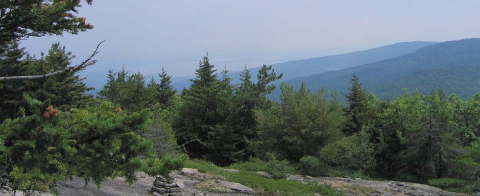
This is a point-to-point hike along Belknap Ridge, hitting eight summits, from Gunstock Mountain to Mount Major with Belknap Mountain being the highest elevation reached on this trek. There are views from each of the summits. Note that the mileage below is approximate.
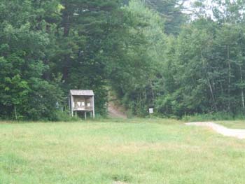
- Start the hike from the Gunstock Ski Area parking lot.
- Head up Brook Trail, blazed in yellow, which starts to the left of the main ski lift.
- After 1.5 miles on Brook Trail, you will reach a junction with Saddle Trail. For now, turn right to stay on Brook Trail.
- Follow Brook Trail for an additional 0.2 mile to reach the summit of Gunstock Mountain.
- Retrace your steps for 0.2 mile back to the junction between Brook and Saddle Trails.
- Turn right onto Saddle Trail and descend the white-blazed path for 0.1 mile which will bring you to a trail junction at a col.
- Overlook Trail (blazed on orange) goes to the left and Blue Trail goes both right and straight. Go straight on Blue Trail, ascending for 0.5 mile to arrive at the summit of Belknap Mountain which has a fire tower from which there are excellent views.
- Descend from Belknap Mountain on the other side, keeping straight all the way for 1.9 miles which will bring you to Round Pond.
- The first 0.2 mile will be on the combined East Gilford, White, and Boulder Trails, then the White Trail veers off to the right; keep going straight.
- The next 0.3 mile will be on the combined East Gilford and Boulder Trails, then East Gilford Trail will turn left; keep going straight.
- The next 0.4 mile is on Boulder Trail which will then veer to the right; keep going straight (maybe a little left at this junction).
- The final 1.0 mile to Round Pond is on Round Pond Link.
- From Round Pond, turn left onto Red Trail and climb for 0.8 mile which will bring you to Mount Klem.
- At the trail junction with Red and Quarry Trails, turn left to get on Quarry Trail.
- Follow Quarry Trail for 0.5 mile to reach Rand Mountain.
- Keep hiking on Quarry Trail for another 0.5 mile to reach West Quarry Mountain.
- Still on Quarry Trail, go another 0.8 mile to summit East Quarry Mountain.
- Continue another 0.5 mile on Quarry Trail which will bring you to North Straightback Mountain and a junction with a bypass trail.
- Veer left onto the bypass trail and follow it for 0.3 mile to its end at a T-junction where it meets up with Major-Straightback Link.
- Turn left and follow Major-Straightback for 0.7 mile until it ends at a T-junction with Brook Trail.
- Turn right onto Brook Trail and follow it for 0.2 mile which will bring you to the summit of Mount Major where you can enjoy the stunning views over Lake Winnipesaukee.
- Descend from the summit in a northerly direction on Mount Major Trail (marked "Main Trail" on the map) for 1.7 miles to reach the Mount Major parking lot.


| Place | Split Miles* |
Total Miles* |
||
|---|---|---|---|---|
| Gunstock parking lot (930') | 0.0 | 0.0 | ||
| Jct. Brook Trail/Saddle Trail (2100') | 1.5 | 1.5 | ||
| Gunstock Mtn. (2250') | 0.2 | 1.7 | ||
| Jct. Brook Trail/Saddle Trail (2100') | 0.2 | 1.9 | ||
| Jct. Saddle Trail/Blue Trail (2000') | 0.1 | 2.0 | ||
| Belknap Mtn. (2382') | 0.5 | 2.5 | ||
| Jct. East Gilford Trail/White Trail | 0.2 | 2.7 | ||
| Jct. East Gilford Trail/Boulder Trail (2100') | 0.3 | 3.0 | ||
| Jct. Boulder Trail/Round Pond Link (1550') | 0.4 | 3.4 | ||
| Round Pond (1652') | 1.0 | 4.4 | ||
| Mt. Klem (2001') | 0.8 | 5.2 | ||
| Rand Mtn. (1883') | 0.5 | 5.7 | ||
| West Quarry Mtn. (1844') | 0.5 | 6.2 | ||
| East Quarry Mtn. (1850') | 0.8 | 7.0 | ||
| North Straightback Mtn. (1910') | 0.5 | 7.5 | ||
| Jct. bypass trail/Major-Straightback Link | 0.3 | 7.8 | ||
| Mt. Major summit (1786') | 0.9 | 8.7 | ||
| Mt. Major parking lot (650') | 1.7 | 10.4 | ||
| * mileage is approximate | ||||


Click for a larger trail map (it will open in a new window).

|
|
|||||
|
|
|||||
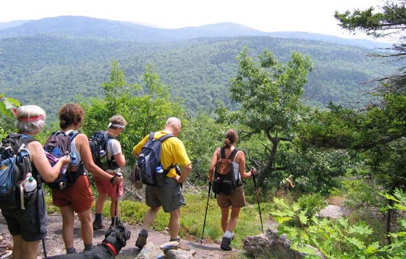
The hike along Belknap Ridge has a little of everything - views, climbs, wooded trails, ponds, and ledges. The hike involves summiting eight peaks, the tallest being Belknap Mountain at 2,382 feet. For the purists, there is a ninth peak, Mount Rowe, located to the north of Gunstock Mountain, that we did not include in our ridge traverse. In fact, the two other times I've done this hike with a group of strong hikers we never made it up Mount Major which is the last we'll come to.
There are many trails that crisscross the route we followed, so we made sure to stay together as a group. There are limited signs, but the trails are well blazed (mostly).
We ascended Brook Trail in what might be called "steamy" conditions - hot and humid - and then got onto the trail leading to Belknap. At the summit of Belknap Mountain, a couple members of the group were inducted into the New Hampshire junior fire warden corps after fulfilling the entry criteria.


We continued on to Round Pond, snacking on blueberries and raspberries along the way. Unfortunately we had two injuries going down Boulder Trail when people slipped on wet moss. After some on-trail first aid, both injured parties were able to continue the hike and hopefully the injuries are on the mend.
We had lunch at Round Pond, then summited Mount Klem followed by Rand Mountain then on to West Quarry Mountain. At some point on this trail we were treated to a light sprinkle, which quickly developed into a serious downpour accompanied by thunder and lightening.


Undaunted, the group got to the summits of West Quarry, East Quarry, and North Straightback. Faye put her orienteering map reading skills to good use by finding a bypass trail that got us to the Mount Major summit trail a little more quickly. After Major's summit we finally headed down to the parking lot and were pretty well soaked by the time we reached our vehicles.
Most were calling this hike an "adventure" - it would have been a lot more enjoyable without the rain, thunder, and lightening.

|
|
|||||

Since this is a point-to-point hike, it requires spotting cars at both ends of the trek.
 Mount Major Parking Lot:
- The parking area is located on Rt. 11, 4.2 miles north of Alton Bay.
- Heading north, the parking area turn-off is located shortly after a scenic vista and is on the left-hand side of the road.
- Heading south, the parking area turn-off is located a couple miles after passing the junction with Rt. 11A and is on the right.
Gunstock Ski Area Parking Lot:
- From I-93, take exit 20 (for Rts. 3, 11, 132, 140).
- Head east on Rt. 11.
- Then take Rt. 11A east.
- Turn right at a big sign for Gunstock Ski Area and follow the road down to the large parking lot.
Facilities
Bathrooms at the Gunstock complex.
Mountain bike trail maps available at the Gunstock complex.
More Belknap Ridge Trail Reports
- Belknap Mtn. via Red and Blue Trails on 9/07/2009
- Mt. Major via Mount Major and Brook Trails on 8/16/2009
- Mt. Major via Brook Trail on 3/28/2009
- Mt. Major via Boulder Loop and Brook Trails on 7/3/2006
- Mt. Major via Boulder Loop and Brook Trails on 7/1/2000
- Mt. Major via Boulder Loop and Brook Trails on 5/6/2000
- Round Pond on 9/18/1999
|
|
|||||


Website by
![]() LeapfrogProgramming.com
LeapfrogProgramming.com
© 1998-2025
![]()
| The information on this site may freely be used for personal purposes but may not be replicated on other websites or publications. If you want to reference some content on this site, please link to us. |