Sugarloaf Mountain (Nash Stream Forest)
| Mountain: | Sugarloaf Mtn. (3710') | |
| Trails: | Sugarloaf Mountain Trail, Cohos Trail | |
| Region: | NH - Northern Nash Stream Forest | |
| Location: | Strafford, NH | |
| Rating: | Moderate/Difficult | |
| Features: | Summit, views, brook | |
| Distance: | 4.2 miles | |
| Elevation Gain: | 2200 feet (cumulative) | |
| Hiking Time: | Actual: 3:21 | |
| Outing Duration: | Actual: 5:15 | |
| Season: | Fall | |
| Hike Date: | 08/06/2006 (Sunday) | |
| Last Updated: | 08/08/2008 | |
| Weather: | Sunny, clear, 70 degrees, light breeze | |
| Author: | Webmaster |
Route Summary
Hike up Sugarloaf Mountain Trail to the summit of Sugarloaf Mountain and return via the same route.
| Place | Split Miles |
Total Miles |
Split Time |
Total Time |
|||||
|---|---|---|---|---|---|---|---|---|---|
| Nash Stream Road | 0.0 | 0.0 | 0:00 | 0:00 | |||||
| Field/Camp Remains | 1.6 | 1.6 | 1:30 | 1:30 | |||||
| Sugarloaf Mtn. summit | 0.5 | 2.1 | 0:28 | 1:58 | |||||
| Field/Camp Remains | 0.5 | 2.6 | 0:21 | 2:19 | |||||
| Nash Stream Road | 1.6 | 4.2 | 1:02 | 3:21 |
|
|
|||||

|
|
|||||
This Sugarloaf Mountain is located in the Nash Stream Forest; not to be confused with those located in the White Mountain National Forest. There were incredible views from the summit and I only encountered one other soul on the trail. The Sugarloaf Mountain Trail leads to the summit and is part of the Cohos Trail.
From the parking area, cross the bridge, then walk up the driveway on the left which leads to a camp. Continue walking past the camp, cross a little footbridge over a small stream, and follow an old logging road which is the trail.
After about ten minutes, there will be a fork in the trail. Going left will take you on the Sugarloaf Arm Trail; stay to the right to follow the Sugarloaf Mountain Trail. There is sign at this junction. After about another ten minutes, there will be another fork. This junction is unsigned but you should again stay to the right.
For a little while, the stream that you crossed at the start of the trail will accompany the trail on the right-hand side. At one point there are even a couple small but pretty cascades.

The trail climbs pretty much straight up, mostly steeply, but sometimes only moderately. There was a light, pleasant breeze for most of the hike. The footing on much of the trail was a mixture of soft dirt and small rocks. It was okay for the hike up, but not the greatest footing for a descent.
There were a bunch of blue bead lilies along the trail. Up higher, there were moose prints on the trail and also a lot of moose scat; this is the North Country after all. There was also some fresh scat on the trail that appeared to be from fox. And there were a few toads along the path too.
After much climbing, you reach a clearing at 1.6 miles. In this clearing is the rubble from an old fire warden's cabin. And reportedly there is a spring-fed well just left of the cabin although I didn't look for it.
The trail continues pretty much in a straight line up from where you entered the clearing. At first it is really overgrown and you have to wonder if you're on the trail. But after wading through chest-high growth for about ten yards, there will be a "trail" sign tacked to a tree. Even after knowing where this sign was on the descent, I looked for it from the clearing and couldn't see it from there. The signage on this trail is pretty poor and the trail is overgrown in a few spots, but such is the wild and wondrous nature of the Cohos Trail.
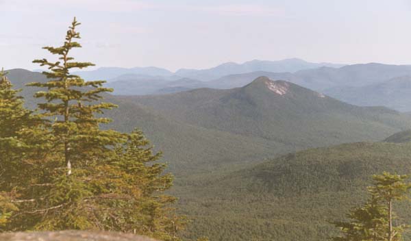
After more climbing, the rocky summit is reached. The views, although not quite 360 degrees, are panoramic and stunning. The Percy Peaks can be viewed, as well as many other peaks that are part of the Nash Stream Forest. Down below, at the foot of the mountain to the northeast is the 200-acre Nash Bog. It looks like a wide-open area with a stream running through it. It used to be Nash Pond until its dam gave way in 1969 and resulted in everything downstream/downhill getting flooded. Now it is a wetlands area.

The sound of the wind coming from the northwest side of the summit was ferocious. On the summit proper, I was sheltered from the strong winds, but descending on the rock slabs, past the sheltering firs, you could feel its force which matched the intensity of the "whooshing" noises it produced. As with most windy areas, the only vegetation surviving other than the trees, are the very-low-growing (about a quarter inch tall) alpine plants. In this case it was mountain cranberry.
I ate my lunch while taking in the views and watching and listening to a junco singing. There were also swallows flying about. After a while, I reclined on a sun-warmed slab, closed my eyes, and just enjoyed the sound of the wind and the birds flitting about. Since I started so late, I was only able to spend an hour and a half at the summit (because I didn't want to descend in the dark); but I could have easily spent all day there.
But as always, it's necessary to return at some point. I descended slowly and carefully, yet still slipped several times with the precarious footing. Closer to the bottom, the footing was better.
For the drive out of the forest, I was treated to a huge-looking, low, full (almost) moon. All in all, it was a wonderful day in the North Country.

|
|
|||||
|
|||||

 Driving Directions
- From Groveton, NH, take a right off of Route 3 and onto Route 110 East.
- After 2.6 miles on Route 110, take a left onto Emerson Road.
- Follow this road for 2.2 miles until the road makes a sharp right-hand turn. At this point, turn left onto Nash Stream Road and follow it for 8.2 miles to an unsigned parking area on the right, just before a bridge.
- The trail starts just after the bridge, on the left. There is no sign for the trail on the road.
Other Notes
Nash Stream Road is seasonal and is generally open from May to December.
|
|
|||||
Website by
![]() LeapfrogProgramming.com
LeapfrogProgramming.com
© 1998-2025
![]()
| The information on this site may freely be used for personal purposes but may not be replicated on other websites or publications. If you want to reference some content on this site, please link to us. |


