
Cutler Coast Preserve
Bold Coast
| Destination: | Cutler Coast Preserve | |
| Trails: | Inland Trail, Coastal Trail, Black Point Brook Cutoff | |
| Region: | ME - Central Southeast Cutler Coast Public Reserved Land | |
| Location: | Cutler, ME | |
| Rating: | Easy/Moderate | |
| Features: | Ocean, views, cliffs, bogs, loop hike | |
| Distance: | 5.8 miles | |
| Elevation Gain: | 500 feet (cumulative) | |
| Hiking Time: | Actual: 3:00 Typical: 3:10 | |
| Outing Duration: | Actual: 6:00 Typical: 5:00 | |
| Season: | Spring | |
| Hike Date: | 06/10/2008 (Tuesday) | |
| Last Updated: | 02/06/2012 | |
| Weather: | 60 degrees, overcast | |
| Author: | Webmaster |

Route Summary
This is a loop hike with a 1.5-mile leg hugging the Bold Coast with wonderful views out to the Atlantic Ocean and along the rocky shoreline. The trail is blazed in blue and the official junctions are signed (you can ignore any unmarked side paths).
- From the Cutler Coast Preserve parking lot, start on Inland Trail. When standing on the road, looking at the parking lot, the trail starts near the front left-hand side.
- After 0.4 mile you will reach a junction with Coastal Trail going straight and Inland Trail turning right. We'll return via the right-hand branch so for now keep going straight onto Coastal Trail.
- After 1.1 miles on Coastal Trail you will reach a trail junction and the ocean. Straight ahead is a spur to a rugged peninsula; to the right is Coastal Trail, and the trail to the left can be ignored.
- First, head straight ahead and descend down to the rocky cliff to enjoy wild views while the ocean crashes all around you.
- Return to the junction, then head southerly on Coastal Trail (a left-hand turn when coming up from the peninsula; a right-hand turn if proceeding directly from the parking lot).
- Follow Coastal Trail for another 1.5 miles. You will go over small ups and downs as the path hugs the coast and then you will arrive at a signed trail junction. Feel free to explore the many very short spur paths to the left on the way which will provide even more views to the ocean.
- Going left or straight at the signed junction would continue the hike along Coastal Trail while a right-hand turn is Black Point Brook Cutoff which we will be following. But first, turn left to check out the cobblestone beach. Then retrace you steps to the junction and pick up Black Point Brook Cutoff.
- After hiking for 0.8 mile on Black Point Brook Cutoff, the path will end as it comes to a T-junction with Inland Trail.
- Turn right here (northeast) to head back to the parking lot. Take care at this junction; I found it to be a bit confusing.
- After 1.6 miles on Inland Trail you will be back at the first junction we encountered near the beginning of the hike.
- Turn left and walk for 0.4 mile on Inland Trail to return to the parking lot.


| Place | Split Miles |
Total Miles |
Split Time |
Total Time |
|||||
|---|---|---|---|---|---|---|---|---|---|
| Cutler Coast Preserve parking lot (135') | 0.0 | 0.0 | 0:00 | 0:00 | |||||
| Trail jct. at the coast (100') | 1.5 | 1.5 | 0:42 | 0:42 | |||||
| Jct. Coastal Trail/Black Point Brook Cutoff (30') | 1.5 | 3.0 | 0:57 | 1:39 | |||||
| Jct. Black Point Brook Cutoff/Inland Trail (150') | 0.8 | 3.8 | 0:27 | 2:06 | |||||
| Cutler Coast Preserve parking lot (135') | 2.0 | 5.8 | 0:54 | 3:00 |


|
|
|||||


|
|
|||||


This is a wonderfully remote hike that will bring you along the Atlantic Ocean's shoreline in a section called Bold Coast due to its ruggedness and wild beauty. Although it was an overcast, low-visibility day, the landscape was still fantastic. The hike makes a large loop also bringing you through quiet woods and over boardwalks in boggy areas. Wildflowers and moose prints were plentiful. I didn't encounter anyone else on the trail which added to the neat out-in-the-middle-of-nowhere ambiance.
Since this is a long trip report, I've divided it into sections:
To the Coast | The Bold Coast | Inland Hike

To the Coast
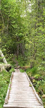
Embarking on the Inland Trail, I soon crossed boardwalks and bog bridges through some wet areas. The walking was easy with only gentle inclines and declines from the parking lot to the ocean. There were many white flower blossoms in the shady woods including Canada Mayflower (Maianthemum canadense), starflower (Trientalis borealis), common strawberry (Fragaria virginiana), wild sarsaparilla (Aralia nudicaulis), and lots and lots of bunchberry (Cornus canadensis). Some of the bunchberry flowers where cream-colored instead of their regular bright white.
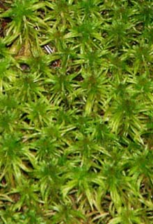
I wound through the forest beneath spruce and firs and crossed a lightly flowing brook on a nice stone walkway with a beautiful mossy area upstream. I then saw the first of many moose prints that I would encounter throughout this hike. As I neared the coast the breeze picked up a bit and I could smell the salt air and hear the crash of the waves and the rumble of boat motors. Just before reaching the trail junction there was a bunch of yellow clintonia (Clintonia borealis) boasting large shiny leaves and graceful yellow flowers.

The Bold Coast
At the junction, I first headed straight ahead, and down some stone steps, to check out a little rocky peninsula on a ledge above the pounding surf. I passed by some beach pea (Lathyrus japonicus) plants with vibrant purple and hot pink flowers and some white-flowered yarrow (Achillea millefolium), as I made my way along the rocky path to the farthest point of the ledge. It was exhilarating to be out on the promontory looking at the jagged coastline while surrounded by breaking waves below. The shoreline is totally undeveloped with rugged ledges topped by dark green conifers.
The promontory was a difficult spot to leave but I continued on since there was a lot more exploring left to do. I climbed back up to the main trail and turned left to continue on Coastal Trail. This 1.5-mile trail segment proceeds along the coast, often dipping back into the woods never far from the shore. For the most part you are walking along clifftops and climbing up and down steep, but low knobs. The many vistas are fantastic and the wooded sections peaceful and pretty.

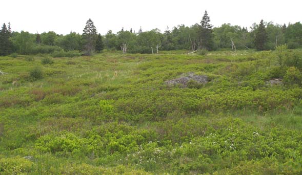
I hiked up and over several knobs and enjoyed the numerous outlooks which always revealed a new aspect of the landscape. At various points the view was out to the expansive ocean or boulder-studded coves, down to a cobble beach or a narrow gorge, along the shoreline's coves and headlands, or even inland to the conifer forests and open meadows.
I walked along a narrow path carpeted on both sides with bunchberry with a few clumps of ferns rising above them. Out in the open again, I passed by a bunch of chokeberry plants covering a wide area. These are low-growing shrubs with five-petaled white flowers. I ambled through a meadow and saw some striking purple-colored larger blue flag (Iris versicolor). At one point the trail dipped down to the shoreline with orange survey ribbon, blue paint blazes, and cairns guiding you across the cove and then back up into the woods.

Eventually I reached the junction with Black Point Brook Cutoff which was the trail I needed to take for this 5.8-mile loop. Coastal Trail continues onward enabling a 9.8-loop to be made. The marvelous scenery made for slow progress, so due to time constraints, I reluctantly decided to do the shorter loop.
But first I turned left which quickly led to a stony beach. From the junction, you could also go straight on a faint trail that skirted above and around the beach area but the main trail goes out to the beach and them climbs up a ladder on the far side to continue the coastal trek where the two paths converge. I found a medium-sized rock on the beach to sit and enjoy lunch while I contemplated the sea rushing in among the boulders and ledges and shooting up white spray.

Inland Hike
Leaving the cobblestone beach, I returned to the junction and followed Black Point Brook Cutoff away from the ocean. I climbed uphill on a narrow path to a rocky outlook over meadows and woods and a bit later up to another knob with the same viewpoint. Also while traveling Black Point Brook Cutoff, I encountered some rhodora shrubs (Rhododendron roseum) sporting magenta blossoms, some narrow boardwalks, and large boulders, and then the path soon ended as it met with Inland Trail.
I turned right (the left branch eventually connects with the portion of Coastal Trail that I skipped – part of the 9.8-mile loop) to head northeasterly back towards the trailhead. I headed up on a rocky trail, crossed a wide boardwalk through a meadowy area, and passed over a couple outcrops, one with a view to a nearby small pond. Then there was an earthen bridge crossing a wet area marked by rope and survey ribbons and an unmarked path joined the main trail.

I reached a wonderful section that traversed a bog on narrow boardwalks, allowing close-up inspection of the many plants unique to this environment. Tamarack and spruce trees were scattered about with many shrubs and plants growing closer to the ground. Cotton sedge (Eriophorum vaginatum) is a really neat plant that looks like tall clumps of grass with each stem topped by a white, silky, hairy sphere that resembles a cotton ball. Pitcher plant (Sarracenia purpurea) is a carnivorous plant drawing insects into its water-filled vase-like leaves where they are digested. The flowers grow on a separate stalk and are also strange looking, consisting of a greenish-reddish sphere hanging from the hooked-top stem. Labrador tea (Rhododendron groenlandicum) is a shrub with leathery leaves and white flowers. Three-leaved false Solomon's seal (Smilacina trifolia) has two to four, but usually three, large leaves with several delicate white flowers spread along the central stem above the leaves.
Leaving the bog, I reentered the woods to finish the hike. I soon arrived back at the first trail junction of the trek, and turned left. I finished the last leg in the dusk to return to the parking lot, completing this fantastic day along coastline and through woods, where apparently the moose outnumber the humans.

|
|
|||||


|
|||||


|
|
|||||


Cutler Coast Preserve (also known as Cutler Coast Public Reserved Land) is located in Cutler, Maine on Rt. 191.
- From the junction of Routes 1 and 191 in East Machias, take Rt. 191 southeast where a road sign indicates, "Bold Coast Trail, 17 miles".
- After 17.0 miles, you will reach the Cutler Coast Preserve parking lot on the right.
Facilities
- Toilets at the parking lot.
- Three primitive backcountry campsites.
- Pit toilets at the campsites.

About Cutler Coast Public Reserved Land
Cutler Coast Reserve is a management unit of the Maine Public Reserve Lands System. Its 12,000 acres span Cutler and Whiting, Maine on both side of Route 191. The varied terrain encompasses ocean coast, forested ledges, meadows, peatlands, wetlands, and blueberry barrens.
 The highlight of this property is a large tract between Route 191 and the Atlantic Ocean with hiking trails offering options for a 5.8-mile loop or a 9.8-mile loop. The trail system includes a 3.8-mile segment that hugs the Bold Coast – a stretch of undeveloped land marked by the ocean meeting cliffs topped by spruce-fir forest.
From a few points along this coastal trail, marine mammals such as whales (several species), porpoises, and seals may be seen. Waterfowl such as guillemots and eiders can also be spotted. There are three primitive campsites spread out along the southern end of the coastal trail.
The inland hiking trails are also very special, passing over a variety of terrain with many species of wildflowers. Unusual plants such as Hooker's iris, pearlwort, dragon's mouth orchid, and baked-apple berry grow on the headlands and peatlands. The bogs boast cotton sedge, pitcher plant, Labrador tea, rhodora, and three-leaved false Solomon's seal. Moose, deer, grouse, eagles, falcons, and owls frequent the area.
Aside from hiking, the reserve supports deer and grouse hunting in the fall and spring fishing in Schooner Brook.
Maine Bureau of Parks and Lands
Eastern Region Office
Airport Road
PO Box 415
Old Town, ME 04468
207.827.1818

Cutler Coast Reserve Property Use Guidelines
To ensure a safe and pleasant experience for yourself and others, please follow these rules:
- The three primitive campsites located near Fairy Head are available on a first-come, first-served basis. Please register at the trailhead kiosk to ensure a space. Camping is not allowed anywhere else on the property.
- Open fires are prohibited because of their destructive potential in such a remote, windswept area. However, campers may use self-contained stoves that produce no ash.
- Do not discharge firearms within 300 feet of campsites, marked hiking trails, or boat launches. Loaded firearms are not permitted at campsites or on hiking trails.


Website by
![]() LeapfrogProgramming.com
LeapfrogProgramming.com
© 1998-2025
![]()
| The information on this site may freely be used for personal purposes but may not be replicated on other websites or publications. If you want to reference some content on this site, please link to us. |


