Boulder Loop Ledges in the Moat Range
| Area: | Boulder Loop Ledges (1750') (Moat Range) | |
| Trail: | Boulder Loop Trail | |
| Region: | NH - Central East White Mountain National Forest, Moat Region | |
| Location: | Albany, NH | |
| Rating: | Moderate | |
| Features: | Views, ledges, loop hike, covered bridge | |
| Distance: | 3.5 miles | |
| Elevation Gain: | 900 feet (cumulative) | |
| Hiking Time: | Typical: 2:15 | |
| Outing Duration: | Typical: 3:30 | |
| Season: | Winter | |
| Hike Date: | 01/24/2009 (Saturday) | |
| Last Updated: | 06/11/2010 | |
| Weather: | Cool and windy | |
| Author: | Diane King | |
| Companions: | Ten SDHers, two dogs |

Route Summary
This is a loop hike through woods with lots of large, interesting boulders, and up to some ledges where there are great views of the many surrounding mountains.
- Since this was a winter hike and the road was not plowed to the trailhead, we started from the junction of Kancamagus Highway (Route 112) and Dugway Road where we parked our cars.
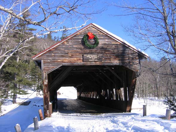
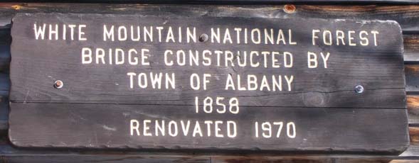
- Walk for about 0.2 mile from Kancamagus Highway down Dugway Road, crossing Swift River via the picturesque Albany covered bridge.
- The Boulder Loop Trailhead will be on your left.
- Follow Boulder Loop Trail for 0.2 mile which will bring you to the loop's junction.
- Turn left to follow the loop in a clockwise direction.
- After a moderate ascent of 1.1 mile you will arrive at a junction with a spur trail on your right.
- Turn right and follow this spur for 0.15 mile which will bring you to some great open ledges with views of Mount Passaconaway, Mount Chocorua, and many others.
- After enjoying the vistas, retrace your steps for 0.15 mile on the spur.
- Turn right on Boulder Loop Trail to continue the circle.
- At first the path descends rather steeply, and then later smoothes out as it returns you to the loop junction 1.3 miles from the ledge spur.
- Veer left/straight which will return you to Dugway Road after 0.2 mile.
- Turn right onto Dugway Road and walk 0.2 mile back to your vehicle, once again passing through the covered bridge.
| Place | Split Miles |
Total Miles |
||
|---|---|---|---|---|
| Winter parking area at end of Dugway Rd. | 0.0 | 0.0 | ||
| Trailhead on Dugway Rd. (860') | 0.2 | 0.2 | ||
| Loop split | 0.2 | 0.4 | ||
| Jct. Boulder Loop Trail/spur to ledges (1750') | 1.1 | 1.5 | ||
| Outlook from ledges | 0.15 | 1.65 | ||
| Jct. Boulder Loop Trail/spur to ledges (1750') | 0.15 | 1.8 | ||
| Loop split | 1.3 | 3.1 | ||
| Trailhead on Dugway Rd. (860') | 0.2 | 3.3 | ||
| Winter parking area at end of Dugway Rd. | 0.2 | 3.5 |
|
|
|||||
|
|
|||||

Trail Guide
This popular hike amongst impressive boulders and up to ledges with excellent views is an appealing excursion in both summer and winter. Since it is roughly only three miles long (summer and winter mileages differ due to road access limitations in winter), it is a hike that is within the ability of many. Good footwear is recommended since this short trail gains 900 feet of elevation and can be somewhat rugged. The rewards are well worth the effort.
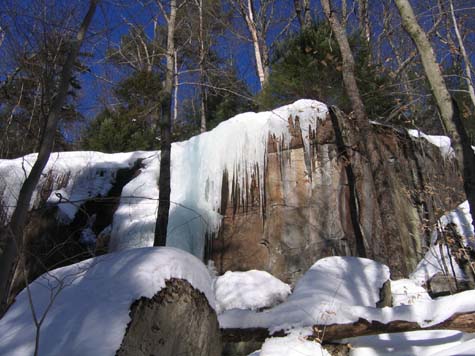
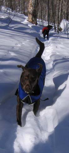
About ten hikers and two dogs met on a windy/cool winter day and walked across the Albany covered bridge to the start of Boulder Loop Trail. The clear skies and bright white snow made it a fine day for snowshoeing. We saw some nice scenery at a couple of outlooks and caught views of the North Conway area.
For a short hike, we put in a fair amount of effort in terms of elevation. After the hike, we met in West Ossipee at the Pizza Barn and discussed plans for the following week's Zealand Hut adventure.
|
|
|||||


|
|
|||||
This loop hike used to have eighteen numbered "stations" that were keyed to an interpretive guide provided by the White Mountain National Forest. Unfortunately that guide is no longer readily available and most of the numbered signs have been removed. Hopefully the stations and brochure will be reinstated at a future date.
In the meantime, the brochure has been reproduced here, courtesy of the forestry service. Although you won't find most of the numbers in the field, the descriptions below can tune you into what you're seeing on the trail and help you better appreciate the trail and its surroundings. The numbered stations were arranged in a clockwise direction; if you wish to hike counterclockwise, then start reading from the bottom of the list.
 Intro: Over 50,000 years ago, the Wisconsin Ice Sheet gathered in Canada and grew southward. Eventually it covered every mountain and valley in New Hampshire. On melting, the ice picked up frozen soil and broken pieces of rock. This glacial material acted like a giant piece of sandpaper being dragged across the land surface. The last of the ice melted away some 10,000 years ago.
As you walk this trail you will see the effects and results of glaciers. The scoured and scratched granite was probably covered by soil before the grinding ice dragged the surface material away and exposed the ancient bedrock.
Stop 1: The things that look like dead leaves growing on the rocks are lichens. Lichens are pioneers. They are the first plants to cover bare earth and rock. A lichen is a combination of two plants, an algae, and a fungus. The fungus absorbs and stores water, which the algae combines with sunlight to make food for other plants. The fungus produces an acid which eats into the rock on which it grows. This acid helps to crumble the rock into fine particles. This is one of the first steps in soil formation.
Stop 2: So far, the trail has passed through a broad-leaf or deciduous forest. Starting at this point, evergreens, or conifers, such as the nearby spruce, become mixed with the broad-leafed trees.
Stop 3: Before you is evidence of the damage done by a typical New England "Nor'easter". The high winds of these coastal storms have uprooted several trees in the vicinity, including the pine tree crossing the trail. The majority of these trees have fallen in the same direction, pushed by the wind.

Stop 4: New growth of red spruce is taking place here. Red spruce is able to grow as a seedling in the shade of the surrounding bigger trees. When trees fall and a clearing such as this one is opened, the seedlings grow toward the sunlight.
Stop 5: From this point you can see the Swift River and the Kancamagus Highway weaving through the Passaconaway Valley below.
Stop 6: Expansion within the granite masses causes fractures known as sheet joints (cracks parallel to the rock surface). The parallel cracks before you are illustrative of this jointing. The glaciers quarried out fractured pieces of rock, exposing smooth surfaces of bedrock.
Stop 7: This slope is exposed to the sun's rays during midday. It is, therefore, hotter and drier than slopes which receive less direct sunlight. The large conifers are absent here, mainly because they grow better in a moister environment.
Stop 8: This old hemlock was at one time a healthy specimen, as you can see by the size. One can only guess what brought about its death. It could have been a prolonged period of drought. Perhaps lightning, disease, or wind. Maybe the leaves were eaten by insects. Most likely it was a combination of these factors.
Stop 9: The cool moist slopes in this vicinity provide good growing conditions for hemlock and paper birch.
Stop 10: Red oaks are able to tolerate a hotter exposure and drier, stonier soil than most other trees in this region. On this rock outcropping, red oak has little competition from other species.

Stop 11: This is the entrance to the ledges. CAUTION: The sheerness that makes these ledges spectacular also makes them dangerous. You can enjoy the views as much from a safe spot as you can from the cliff edges. Use good judgment and be careful. As you walk out to the ledges, the hollow sound underfoot is caused by joint fracturing of the bedrock. This is the result of physical and chemical changes; water and temperature at work.
Stop 12: This is similar to Stop 7 except it is a south/southeast slope as compared to a west/northwest slope at Stop 7. Originally, this area was bare rock. Over eons of time, lichens, mosses, glaciers, wind, and rain created enough soil to support plant life. Each of these forms of plant life essentially sacrificed itself, making the site suitable for the next stage of succession.
Stop 13: You are in the White Mountain National Forest, one of the 155 National Forests in the United States. These public lands are administered by the Forest Service, U.S. Department of Agriculture. As directed by Congress, renewable forest resources – water, timber, forage, wildlife, and recreation are managed in the best interest of the people. Before you and to the left is an example of the timber management mandate from Congress to grow and harvest timber. It also stimulates the local economy by creating jobs to support the industry. The particular method here is called regeneration or harvest cut. To your right and along the trail for about 800 feet is a selective thinning. To your left is a small clear cut. As you would weed and harvest your garden at home, we are doing the same thing with this stand of trees.


Stop 14: Hemlock trees are capable of surviving for long periods in the shade of other trees. When an opening is created, they take advantage of the added sunlight and grow into good-sized trees.
Stop 15: Foresters refer to this particular decayed granite as rotten rock and use it to cover many of the roads, footpaths, and campsite pads in the White Mountain National Forest. It takes approximately 1,000 years for Mother Nature to wear down solid rock enough to make an inch of soil.
Stop 16: All life depends on water for survival. This small stream is a tributary to the Swift River, which feeds into the Saco River in Conway. The Saco River meanders to Saco, Maine, where it enters the Atlantic Ocean. Streams like this meet many needs before entering the ocean. A few of these uses include fishing, swimming, drinking water, and irrigation of crops.
Stop 17: This mountain shook when boulders crashed down from the cliffs above. The land was pounded and ancient trees were felled. Here, all around you, the boulders came to rest. Trees and underbrush have healed the scars and obscured the once dramatic plunge of the boulders.
Stop 18: The stumps you see here are remains of the old timber sales in the early 1940's. The new growth shows why timber is truly renewable, thus protecting the soil, supporting wildlife, and giving you enjoyment.
|
|||||


The Boulder Loop Trailhead is located in Albany, New Hampshire on Dugway Road which is reached via Kancamagus Highway (Route 112).
Heading east on Rt. 112:
- Travel on Rt. 112 East (Kancamagus Highway) for about 6 miles past the intersection with Bear Notch Road which will be on your left. Or for about 2.8 miles past Rocky Gorge Scenic Area which will also be on your left.
- Following a sign for Covered Bridge Campground, turn left onto Dugway Road.
- Go through the Albany covered bridge and then park in the first parking area on the right just past the bridge. (Or in winter when the road is unplowed, just park on Dugway Road near its junction with Rt. 112.)
- Boulder Loop Trail starts on the opposite side of the road.
Heading west on Rt. 112:
- Travel on Rt. 112 West (Kancamagus Highway) for about 6 miles from the junction of Routes 112 and 16 in Conway.
- Following a sign for Covered Bridge Campground, turn right onto Dugway Road.
- Go through the Albany covered bridge and then park in the first parking area on the right just past the bridge. (Or in winter when the road is unplowed, just park on Dugway Road near its junction with Rt. 112.)
- Boulder Loop Trail starts on the opposite side of the road.
Other Notes
WMNF Recreational Pass
A parking permit is required to park at White Mountain National Forest trailheads and parking areas. You can purchase a WMNF permit from the forest service and other vendors and can also pay-by-the-day using self-service kiosks located in many parking areas.
For more information on parking passes please refer to the White Mountain National Forest website.
Rates:
- $5 per day
- $30 for a year-long pass
- $40 for a year for a household
More Boulder Loop Ledges Trail Reports


Website by
![]() LeapfrogProgramming.com
LeapfrogProgramming.com
© 1998-2025
![]()
| The information on this site may freely be used for personal purposes but may not be replicated on other websites or publications. If you want to reference some content on this site, please link to us. |


